|
Walk through the centre of Rotterdam |
||
|
(4,8 to 8km or 9,5km / 3 to 5mi or 5,9mi)
The walk starts in front of the Central Railway Station.
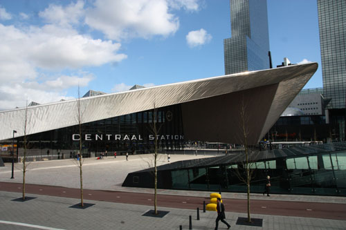
<1> The brand new Centraal
Station replaced the old one from
1957 and was officially opened in 2014. Standing with our back to the newly
built station, looking
right, we see the Groothandelsgebouw.
Construction took place from 1948 until 1952. It had to
solve the shortage of office space that resulted from the
1940 bombing of the city. The idea of building a
multi-company business centre was imported from abroad. This concept reduced the rental costs
(because of the shared facilities) for the smaller businesses for whom the building was intended.
The architect Maaskant was
the senior architect of the building that has a neutral
identical facade of concrete elements. The building is built
around three inner courts. Deliveries are made through
internal roads at different levels. On the roof we see the
former cinema Kriterion. The projection screen was placed in
front of the window. During the intermission the screen
would be rolled up, allowing the audience a view of the
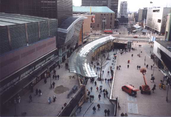
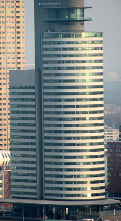
city. To our left is the Delftse Poort building of insurance company Nationale Nederlanden (currently part of the ING Group). With 150m (493 ft) it is was the highest building in the Netherlands at the time of completion. It consists of two towers of different height and a lower central part crowned by a glass dome. It was completed in 1991 and the architect was A. Bonnema. We keep left rounding the square along the Nationale Nederlanden building. On Weena opposite Nationale Nederlanden is the Plaza-building. The building houses offices and apartments. The ground floor is a shopping mall. The casino is here as well. Striking features of the white metal building are the gaudy ornaments over the casino entrance. To the right of the Plaza the Millenniumtoren was completed in 2000. The tower houses a five star hotel and offices. It was designed by Webb Zerafa Menkes Housden Partnership, who earlier had tried their hand at the CN tower in Toronto. According to the architects the shape of the building refers to the "Witte Huis" in Rotterdam, once Europe's tallest building. Because of its likeness with the traditional shape of an American skyscraper it could easily refer to the Empire State Building in New York, as well. We turn left into Weena. At the first set traffic light we cross the street and continue on Weena. After the war Weena remained an empty space for decades. The city council was not sure what to do with it. Especially during the seventies there was a strong opposition against high-rise buildings. Cautious attempts at this like the Shell Building were heavily criticised. ("Capitalism's final erection" an Alderman said) or had to be compensated with adjoining low rise structures. Many plans were presented and rejected, until a final plan was adopted in the late eighties. In no more than five years the street was filled with high rise buildings. We first pass the Unilever building by J. Hoogstad from 1992. The sculpture in front of it moved with Unilever from its former head office elsewhere in Rotterdam. Next to Unilever is the Weena Center (apartments and offices) by the same architect (1990). Just past the next set of traffic lights is the Weenatoren, a
design by Henk Klunder, which was much debated. In the end
the tower was built a bit lower than originally intended.
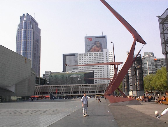
Across from the In front of the Weenatoren we cross Weena at the pedestrian crossing to the right.. On the other side we see the entrance of lounge bar "Toffler", this club is located in a former pedestrian subway. The subway became unsafe and filthy, after which it was closed off and turned into a nightclub. We walk straight on into the Lijnbaan. The shopping mall was opened in 1953. The design of Van den Broek and Bakema, was revolutionary for the Netherlands. For the first time a pedestrian zone was created. Deliveries come via the service streets behind the shops. The offices are also behind the shops. The shops have two stories and a basement. Their width varies. The class of shops has been downgraded a bit over time (Kruiskade and Karel Doormanstraat are more up market for clothing). Because of the fragmented ownership of the shops it has been difficult to modernise the Lijnbaan. All kinds of plans were rejected by individual owners. The construction of the Beurstraverse mall (later on this walk) in 1996 finally prompted some concerted action. Facades and awnings were modernised and the neglected flowerbeds removed. Gradually the class of shops is improving. On the cross roads with the Korte Lijnbaan on left we see the Town Hall from 1920 in the distance. We turn right into the Korte Lijnbaan. This leads us to the Schouwburgplein (Theatre Square).. ?On the Schouwburgplein we see to our right the Concert Hall "De Doelen", home base to the Rotterdam Philharmonic, one of the best orchestras in the country. At its opening in 1966 Rotterdam had been 26 years without a real concert hall. Planning had already started in 1955. Because of numerous alterations construction did not start until 1962. The architects E. & H. Kraaijvanger and R. Fledderus, meant to build a timeless construction, with emphasis on functional aspects. They also tried to express the cultural character of the building, while avoiding monumentality, in order not to scare visitors off. The copper roof and the decorative facade served this purpose.
Left on the square is the Rotterdamse Schouwburg (theatre) by Wim Quist from 1988. It has a modest and rectangular design. We walk straight on keeping De Doelen on our right hand, and towards the Pathé Theatre. This multiplex cinema has seven theatres and 2700 seats. It is situated over a underground car park, so that the construction had to be light. At night the light simmers through the semi-transparent facade. The design from 1992 was by Van Velzen and was completed in 1996. We walk on between cinema and De Doelen towards the Kruisplein square. In 2000 the extension of De Doelen Congress Centre was completed. Hoogstad designed the extension besides and on top of the existing building, thus hiding part of the robust facade. The extension offers the badly needed increase in Congress capacity. Next to that is the yellow brick exterior of the Academy for Music and Dance. The conglomerate of buildings is mish mash of styles. Hoogstad likes to think that the spaces within buildings are much more important than their exterior: "architecture is not meant for picture postcards".
We turn left into the Mauritsweg .
The Westersingel is the canal on your right hand and is
the western boundary of the Cool district. Until the early
19th century the city was confined to its original city
walls. Only in 1811 the (former) Cool
We turn left into Van Oldenbarneveldtstraat. ?The building on the corner draws the attention with a frame with a portrait of the Dutch author Multatuli and the quotation: "Vanaf de Maan gezien, zijn wij allen even groot" (Seen from the moon, were are all the same height). Further along this street, increasingly popular with expensive clothing shops we see at nr nr. 127 (De Nostra) and 119 (Prague) shop windows in Art Nouveau style. From nr. 115 onwards we see mainly new buildings. Close to the city centre, the Cool area suffered badly by the 1940 bombings. At the Karel Doormanstraat we keep going straight on. On the corner of the Karel Doormanstraat and Van Oldenbarneveldtplaats is the ice cream parlour "Capri", an institution for ice cream loving Rotterdammers.
Going further we cross again the Lijnbaan. We continue a little bit further. ? To our left we see the Rotterdam store of Bijenkorf Department store (Breuer en Elzas, 1955-57). Built like a closed box, it is covered with hexagonal white travertine plates, representing a beehive structure ("Bijenkorf" means beehive). On the Coolsingel side there is a statue by Gabo. We can cross the Coolsingel underground or better still at street level.
The Coolsingel used to be a moat and part of
the city's defences. It was filled in the We walk on down the square and turn left into Rode Zand. We turn right on the second street, the Meent. Just before the bridge on the corner of Meent and Westewagenstraat is the former office of the Nederlanden Insurance company designed by Dudok in 1952. On the ground floor and mezzanine floor is the Café and Brasserie Dudok (excellent apple pie). We cross the bridge over the Haagse Veer and turn immediately right into Delfsevaart. We then arrive at the Grote Kerkplein square.
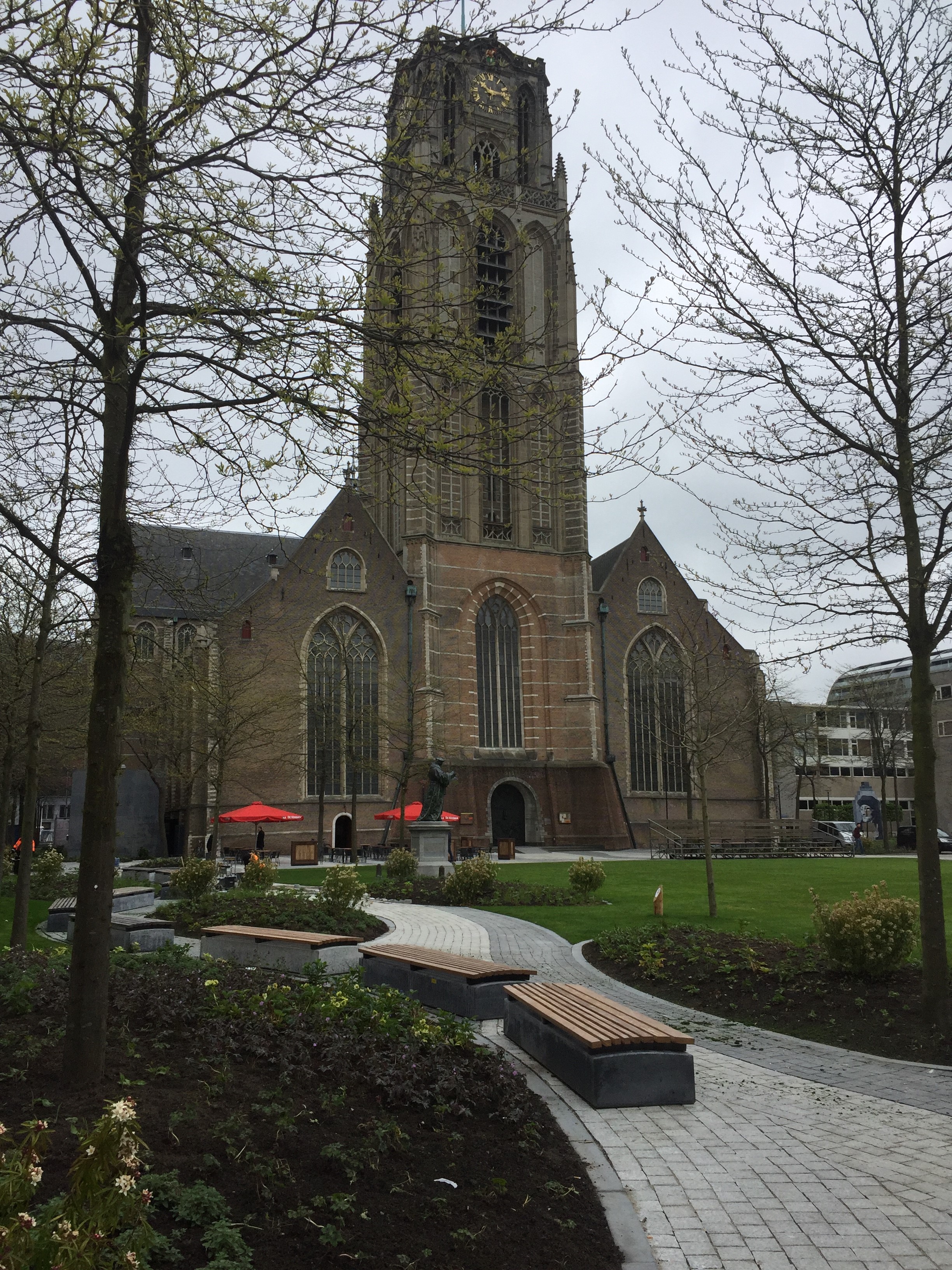
On the square is also the statue of the Rotterdam born humanist Desiderius Erasmus (1469-1536). Although Erasmus only lived here for four years (and never returned) he is celebrated all over town as the city's most famous son. Erasmus studied and lectured in Cambridge, Louvain and Basel and was critic of the church hierarchy, who - in his eyes - was too concerned with gathering worldly wealth and power instead of spiritual matters. Also he resented dogmatism and intolerance and preferred peaceful coexistence and common sense. The statue is from 1622 and designed by Hendrick de Keyser. We cross the Grote Kerkplein square past the church and turn left On our right hand side we see artwork marking
the supposed birthplace of Erasmus. We do not exactly know
where he was born (there is no documentation), but it must
have been somewhere near the church. we retrace our steps and leave the square to left through de Wijde Kerksteeg. We now enter the Hoogstraat. This unpretentious shopping street is the cradle of Rotterdam. The street, clearly elevated from neighbouring streets, was once called Middendam, the dyke that cut off the river Rotte from the river Nieuwe Maas (Rhine). It was the final link completing the sea wall protecting this part of Holland against flooding. Around this dyke and the lock that was built alongside of it, the hamlet of Rotterdam was born. We turn right into the Hoogstraat and walk until the Beursplein square. Here we turn left into the Korte Hoogstraat.
Opposite the Schielandhuis we see the statue in memory of Pim Fortuyn, the Rotterdam politician who was murdered days before the general election of 2002. We turn left and take at the Those who want to cut short the walk now
turn right. Walk until the traffic lights and turn left
towards the Maritime Museum. Continue in this direction
until the Erasmus Bridge, or alternatively, take
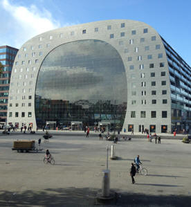
Opposite the Library we see the huge market
hall. It houses a daily covered fresh food
market. Its walls consist of 228 apartments and By a short set of steps on the right side of the tramway platform we get to a pedestrian crossing and a set of traffic lights. Here we cross the Blaak.
We turn left Over the Blaak we now can see clearly the cubic houses (1978-84).This complex is also a creation by Piet Blom, who already had built something similar in the town of Helmond. Under the Cubes are shops and offices. The large cube on the right hand side houses the Rotterdam Youth Hostel (StayOkay). The apartments themselves only have slanted walls and have relatively little space, but have a unique location. One of the houses is open to visitors. At the entrance of the Metro and Railway Station we turn right towards the Old Docks (Oude Haven). We go through the passage across a courtyard and head left onto the Geldersekade. We are now in the Old Docks Quarter. De Oude Haven (Old
Docks) is aptly named. Already in 1351 there was a little
jetty here. During the centuries after that the area was
developed further. On the Geldersekade there were many
commercial buildings and warehouses. These were all
destroyed in 1940. Redevelopment was commissioned to Piet
Blom in 1977. Blom is a typical architect of small scale
building. He created a housing and nightlife district
around the old dock, that now serves as a floating museum
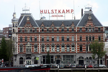
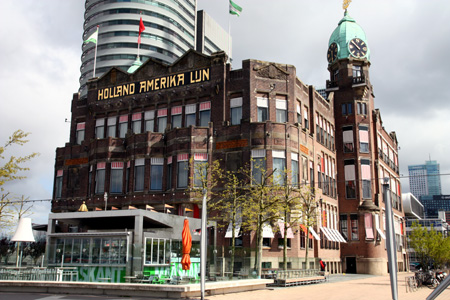
for old ships. On the south side is Right in front of us is the "White House". The White House was completed in 1898 and with its 45metres one of the tallest buildings in Europe. The building did not get good reviews at the time. Critics complained that traditional building methods were used: brick supporting walls, instead of a steel framework, which was already common in the US. On the outside the building has Art Nouveau decorations. Watch out for the plaques representing Labour, Progress, Industry, Trade, Agriculture and Navigation. We continue along the Geldersekade around the White House and turn left into de Wijnhaven.
We backtrack and cross the bridge to our right. Across the bridge we turn right along the Hertenkade. We walk on under the overpass, taking the second passage way from the right (crossing the drive way to the car park, watch the traffic!!). On the other side of the overpass we go up the stairs. Upstairs we turn right towards the traffic lights, where we cross the street towards the My Life gym. This gym cum restaurant was built in 1996 on the foundations of the former Willem Bridge. The Bridge was built in 1878 to connect the city with the newly developed south bank. The bridge was replaced in 1981 by the new Willem Bridge, which we can see to our left. The old bridge was demolished that same year. The dining hall is below sea level. Extensive precautions were taken to enable the building to withstand a collision with a tanker vessel! We walk in a westerly direction (right) along the Boompjes quay.
We walk on and keep to the left down the Boompjes quay..
We walk up the stairs to the Boompjes boulevard continue towards the Leuvenhaven bridge. On the Boompjes we walk past the flag posts of the Flag Parade. A total of 230 flags are in top here. 60 of those advertise the sponsors while 170 are national flags representing the nationalities present in Rotterdam. The flag posts are illuminated at night as national flags are not supposed to hang in the dark. On our left we see the monument to the 3,500 Dutch merchant seamen who lost their lives during the 2nd World War. It is called "De Boeg" (the Bow). The monument was made by the Italian sculptor Fred Carasso. It was placed here in 1957. There was a wide spread feeling that the monument lacked explicit reference to sacrifice, devotion and duty of the seamen. That is why a sculpture groep of seamen and a motto Zij hielden koers (They stayed on course) were added in 1965. We cross the Leuvenhaven Bridge Before the Erasmus Bridge we see the Marathon Monument by Henk Visch of 2001. At its base it carries all the names of the winners (both men and women) of the Rotterdam Marathon since 1985. At the Erasmus bridge we turn left to cross it.
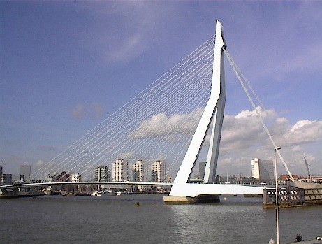
The Erasmus bridge was opened in 1996 and was nicknamed
At the end of the bridge we turn right at the ramp towards the quay
We now face the "Belvedère". This building, designed by Renzo Piano (Milan), houses the regional office for KPN Telecom. All the facades are different. The front facade is tilted and supported by an elegant pylon of approx. 45 meters long. It carries a light show consisting of green squares dotted all over the facade, showing animations designed by young artists. There is a gazetteer just above the ground floor. Renzo Piano rose to fame in the 1970s when co-designed the Pompidou Centre in Paris. We continue along the quay, called the Holland-Amerikalijnkade.
We continue along the quay. Next to the Cruise Terminal is the building of Marine Safety Rotterdam. The building is merely a glass box containing and enormous simulator, used to train (future) ship officers to navigate ships. The building was designed by Sir Norman Foster, who's company is also responsible for the master plan for the entire Wilhelmina Pier.
We continue until the end of the quay.
During the refurbishment of the building into Hotel New York attention was given to the buildings maritime roots. All hotel rooms are different. Also the restaurant and the bar are worth a look inside. Next to the hotel is the jetty for the Water taxi, connecting the Hotel with the Leuvehaven and Veerhaven docks on the north bank. After a recommended visit to Hotel New York we take the Water taxi to the Veerhaven. <8> When we disembark in the Veerhaven dock we see on our right hand the club house of the Royal Yacht and Rowing Club de Maas from 1908. The architect, Hooykaas, was a member himself. The building is in Jugendstil. The Dutch king is honorary president of the club. In front of us at nr. 25 is the World Museum (Wereldmuseum).
The building was built in 1851 as the Royal Dutch Yacht
club. A swish A bit further to the left is a monument dedicated to Pieter Caland, the engineer who designed the Nieuwe Waterweg Canal, giving Rotterdam a direct connection with the North Sea. The street names Veerhaven (Ferry Dock) and Veerdam (Ferry Dam)
refer to the ferry between Rotterdam and the village of
Katendrecht. Ferries left We walk left around the Veerhaven dock.
On the Westplein square we see on our right hand side on nr 1-3 the Atlantic Huis (Buskens, 1930). It was one of the first multi-company business centres in the country. This type of building was copied from the United States. The building is built in Art Deco style. It has rounded corners, framing the central facade like towers. The stained glass windows at the ground and first floors tell the story of modern and progressive Rotterdam with ships, trains, factories, airplanes and the White House. Two plaques represent the Greek gods Hermes (trade) and Neptune (sea). It has been converted into an apartment building. We keep the dock to our left and reach the other side of the basin. on numbers 14 and 15 we see the office building from 1916 built for transport company Van Uden. It was designed by De Roos en Overeynder. The facade has beautiful Art Nouveau elements. The Veerhaven dock itself was dug out around 1850, but proved to too small for the ever bigger sea going ships soon after its completion. Today it is home to private yachts and historic sail boat available for charter. It is also the stage for the yearly Veerhavenconcert by the Rotterdam Philharmonic Orchestra in August. On the corner of Westerkade and Veerhaven is the former office of Steenkolen Handelsvereniging (Coal Trading Company) a family owned conglomerate that started out selling coal to ships. The building was erected in 1914 with volcanic stone and designed by J.P. Stok Wzn. We turn right onto the Westerkade quay. Further down the quay is the statue of Czar Peter the Great from 1997 by sculptor Leonid Baranov. It was a gift from the Russian Prime Minister Tschernomyrdin to the Netherlands. The white facade on the buildings between Zeemanstraat and Rivierstraat are one block. The block was built by P. Vermaas in 1862. Behind these town houses big warehouse are hidden. These are the last examples of town houses connected to warehouses. We turn right at the chips stand and immediately left again up the hill. On our right hand side we see a statue of Queen Wilhelmina (1880-1962) by Charlotte Dorothee van Pallandt from 1968. We walk up the hill and reach the Park Promenade. We pass the Restaurant Parkheuvel built against the hill. It has two stars in the renowned Michelin restaurant guide. It was the first Dutch restaurant ever, that earned the maximum three stars in 2002. In 2006 it changed ownership. It soon recovered one star and since 2009 it has been found worthy of two stars. We walk until the end of the promenade and go down the stairs.
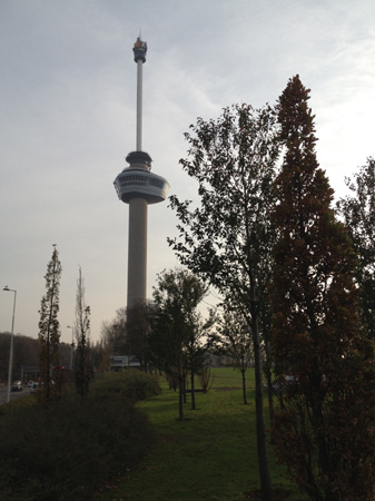
We enter the entrance building The wooden escalators give access to the bicycle and pedestrian tunnels. In the roof of the escalator shaft we see mosaics by Gidding, referring to the tunnels function and position. We go out again cross the street at the pedestrian crossing and turn left following the foot path until the Euromast Space Tower.. <9> The Euromast was built in 1958-60 for Eurotoren company to a design by Maaskant. It was meant as the top attraction of a flower show in 1961. It was originally 100 meters (330 ft) high, because Maaskant held the opinion that you could not recognise anything if you went up any higher. Another reason was the fear that people would not dare to visit a tower higher than that. In 1970 a second tower could be bought from the organisation of another event. That tower was placed on top of the Euromast, making it again the highest structure in the city (180m/590ft), a position it had temporarily lost to the Medical School of the Erasmus University in 1966.
We immediately turn into the first path left, cross the little bridge and keep to the right. We continue along the pond and take the first path to our right. On the left hand we see the labyrinth and the Heerenhuys (Mansion), dating back to 1800. The mansion and estate were added to the park in 1875. We continue past the hedgerow and turn left. We walk towards the white coach house. It was built in 1858. The first floor was the coach masters apartment. We turn right in front of the coach house and then left crossing a bridge and left again. We continue in the direction of the Norwegian Church. The Norwegian Seaman's Church is the result of an
initiative by the Norwegian minister Saxe, who led the
Norwegian Seamen's mission from 1906 to 1922 in Rotterdam. Across the Westzeedijk we see the Erasmus Medical Centre. In 1965 the government decided to establish a seventh medical school in Rotterdam, which would later merge with the Rotterdam School of Economics to form the Erasmus University in 1973. The building was completed in 1968. It is 114 metres (375 ft) high. The high-rise building holds laboratories and offices. The lower buildings lecture rooms. The aluminium plates covering the facade hide a concrete skeleton of the building. The new tower next to it is part of the renewal programme of the old hospital buildings and was completed in 2017. We turn right along the Westzeedijk and cross at the pedestrian crossing.
We now enter the former Hoboken estate. A family domain bought by the city in 1924. Before us we see the Museum of Natural History. The building was the former mansion of the Hoboken family from 1852. The annex was designed by Meccanoo in 1995.
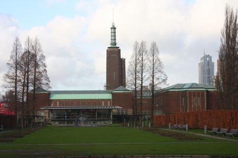
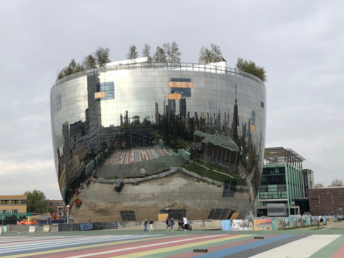
We walk through the building via the pedestrian slope into the museum park. The Museum Park was designed by the bureau OMA of Rem Koolhaas. The design was completed in1992. The park is explicitly artificial and does not connect with the museum garden of the Museum Boijmans Van Beuningen and the rose garden next to it. Lots of concrete and tarmac. From the museum zone we reach the Romantic Garden by a bridge. Behind that is the fairground used for festivals and the open air cinema in august and september. <10> At the end of the park on the right hand side is the Museum
Boymans Van Beuningen. To the left is the Depot. This
exceptional structure opened its doors in 2021 and serves as
storage for art currently not on display and restauration
studios. It is publicly accessible and has a roofgarden and
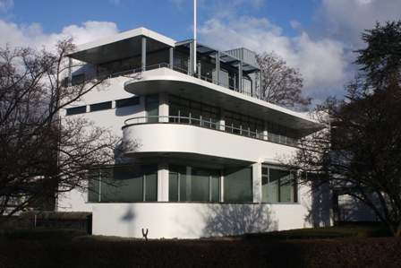
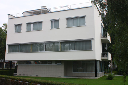
restaurant op top. Before us is the Dutch Institute for Architecture. The design (1988) is by Jo Coenen. The building was completed in 1993. The three functions of the institute are housed in separate parts of the building. The archives are in the bent arcade at the back. The research staff and library are in the glass building in the middle. The exhibitions take place in the square box to the right. The arcade is lit at night by coloured light tubes and form a piece of art by Peter Struyken. On the left side is a restaurant named after the architect. In the water is a sculpture by Auke de Vries. We turn right (Museumpark) and see some white villa's on our left. On the corner of Jongkindstraat and museumpark is a villa designed by Stokla (1938). It main features are the rounded balconies and the awnings. Since 1993 it houses the Chabot Museum, dedicated to the Rotterdam expressionist painter Hendrik Chabot (1894-1949). Those interested in architecture would do
well to sidestep a mere 100 metres into the
Jongkindstraat At Jongkindstraat nr 12 is the Villa Sonneveld from
1933. It was built by Van der Vlugt, commissioned by the
Sonnenveld family. Mr Sonneveld was member of the board of
the Van Nelle coffee, tea and tobacco company. Both
Brinkman and Van der Vlugt had designed the modernist Van
Nelle factory a few years earlier (now a national
monument). The house is a perfect example of modernist
architecture, with lots of glass and steel, giving the
construction a light impression. The house was recently
acquired by the Netherlands Institute for Architecture
next door and is now open for visitors (tickets at the
Institute to your left). The house has been meticulously
restored to its former glory. The house was designed into
smallest detail. From stairwell to teacup, from doorbell
to rooftop garden. The Sonneveld family moved here in 1933
without taking anything with them from their previous
home. The house give a perfect impression what it must
have been like to live
We return to the corner of the Jongkindstraat and Museumpark and turn left
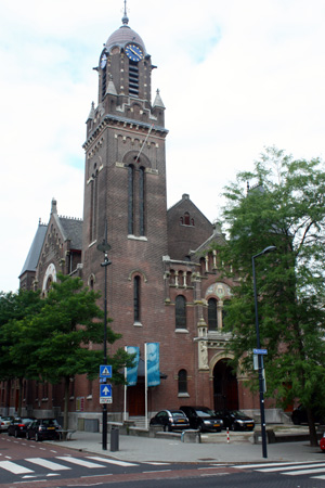
We continue towards the Westersingel. On the corner of Museumpark and Westersingel (nr. 76) is the Remonstrant Church from 1897. The tower is its most striking feature. The portal on the Westersingel side is decorated with the motto: "Eenheid in het nodige, Vrijheid in het onbekende, In alles de Liefde" (Unity in the necessary, Freedom in the unknown, In everything Love). Above that is a mosaic with an angel and the letters Alpha and Omega. On the right hand side of the bridge is a sculpture based on a painting by Picasso (1881-1973) by the norwegian Carl Nesjar (1920). It originally stood on the corner of Weena and the Kruisplein, but was moved here in 2003. It is called Sylvette after one of Picasso's models, whom he painted and drew more than 40 times in 1954. <11>
At the other side of the water we can take tram line 7 back to the Central Station (direction Oudlaan). . Alternatively we can continue the walk to towards the Central Railway Station. Turn left across the water into Eendrachtsweg, keeping the water on our left hand side. We cross at the traffic lights and walk on to the square called Eendrachtsplein.
We cross the Mauritsweg to our left at the pedestrian crossing walking around the pavilion on our right hand side The pavilion is known as the Old Tram House and was built as a tram stop shelter in 1904. It has been moved around the city no less than six times and served as many purposes, like traffic control post, ticket office, tourist information booth until came here in 1971 as a tea room. Later it got fame as one of the few bars with a all-night license. Presently it is a snack bar selling kebab. We continue around the Tram House down the steps leading to the Sculpture Gallery.
We continue along the water. On our right hand side we see Café de Unie and the Calypso building that we saw earlier on this walk (see page 29) By now we see the Central Railway station in front of where the walk ends.
last update: 09-07-2015 |
||
 The
The 